map of india
ganges River
|
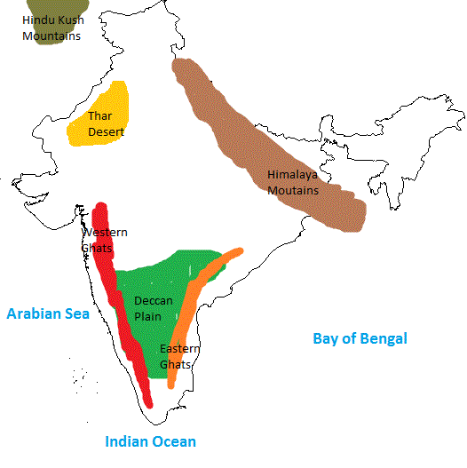
The Ganges River is one of the most important features in India today and back then. The Ganges River is about 1,560 miles long, flowing from the Gangotri Glacier in the Himalayas to the Bay of Bengal. Areas around the river are heavily populated regions due to the rich, fertile land in that area to grow many crops. Some of the most popular crops are "rice, grains, oil seed, sugarcane, and cotton," according to http://www.factmonster.com/encyclopedia/world/ganges.html. Although the land is ideal for farming there are some risks such as the river banks flooding due to a heavy rainfall. The floods can seriously damage crops and homes as well.The Ganges River has a strong water source from melting snow from the Himalayas therefore the river should be there for many centuries to come. The Ganges river is the second largest River in the world but just as important as the first. This river we change India's water usage and India's population would definitely drop.
|

|
indus River
|
The Indus River is the longest most important river in all of the rivers in India. This river runs from the Himalayas, through Afghanistan, India and two other countries, into the Arabian Sea. This river is 3,100 km long witch is 700 km longer than the Ganges River. Due to study of ancient transcript the ancient Indians called the river Sindhu. The river gets it water source from the Hindu Kush Mountains and the Himalayas. Farm is also an important factor to the Indus River Valley. The Indus River Valley carries rich soil sediments from the mountains. The Basin of the River takes up 1 million squared km of land. The Indus River is to India as the Nile is to Egypt. In conclusion without the Indus farming in India would be pretty hard.
|

|
Photo from kudumomo
